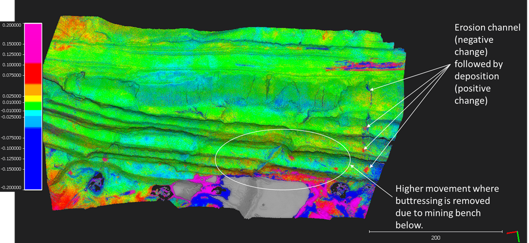
Erosion mapping can be used to determine the acceptability of landform stability (and compliance with completion criteria).
To assist in the monitoring of rehabilitation or other areas that are being impacted by erosion, routine scanning can determine if erosion is increasing, accelerating or if the landform has achieved a stable shape.
Erosion monitoring typically requires the capture of the slope upon completion and then routinely monitored over time. Comparison can be evaluated against design or preferably against a completion flyover.
Erosion analysis can demonstrate where the erosion is occurring, deposition as well as the change in depth and width of erosion over time.
Erosion mapping often goes hand in hand with vegetation mapping and rehabilitation monitoring to create a holistic picture of your landscape.

